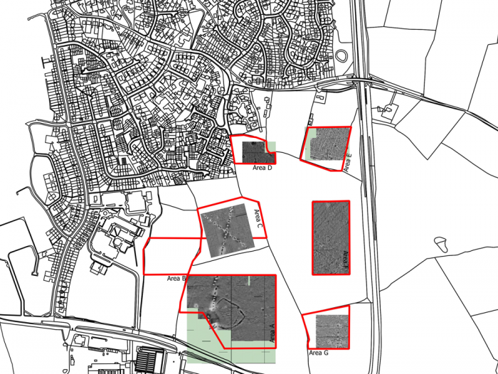
In addition to intrusive evaluation procedures such as trenching, test-pitting and the monitoring of boreholes, Archaeology England offers a range of non-intrusive investigative techniques, in particular geophysical surveys (magnetometer), field-walking, GPS surveys, metal-detector surveys & topographical surveys. Evaluation methodologies of this type are often requested by local authority archaeologists at an early stage in the pre-planning process and they can form a valuable tool in the preparation of strategies to mitigate the impact of proposed developments on the buried archaeological resource.
Archaeology England also offers services designed to survey and record standing buildings and other structures, either as part of the pre-planning requirements associated with a development or as a Condition of planning. Such work can vary from a simple photographic survey to the preparation of a detailed archaeological report (Historic England Level 3 or 4) incorporating a 3D, laser-scanned, archaeological survey, detailed photography and the preparation of background documentary research.
Whatever survey is required, Archaeology England has the necessary expertise to undertake the work and produce a high quality technical report on the results.