
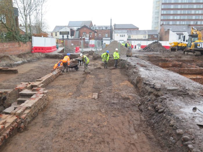
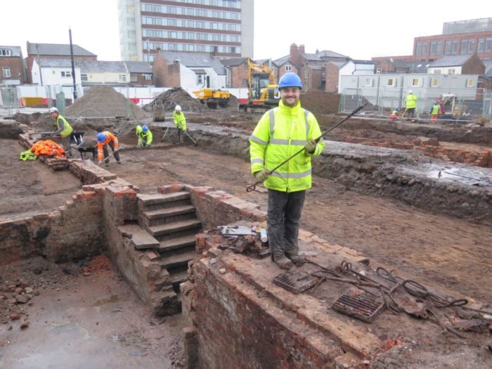
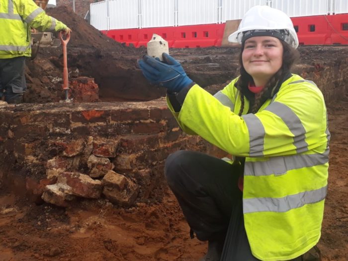
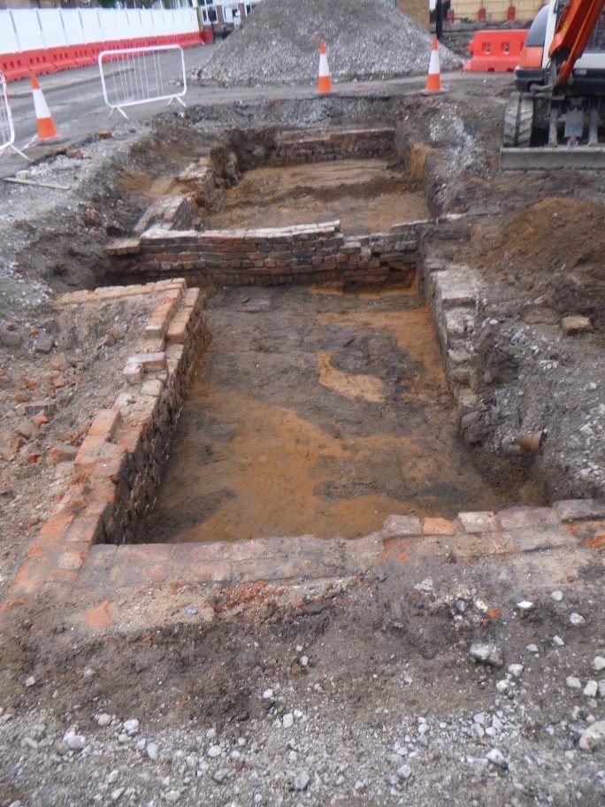
Between November 2019 and March 2020, Archaeology England undertook an excavation at Regent Road car park in Altrincham. The excavation was the result of a planning condition required of the development taking place on the site, as recommended by Greater Manchester Archaeological Advisory Service (GMAAS). GMAAS provides specialist advice regarding any archaeological matter within Greater Manchester to planners and developers and also holds and manages the Historic Environment Records (HER) for the region.
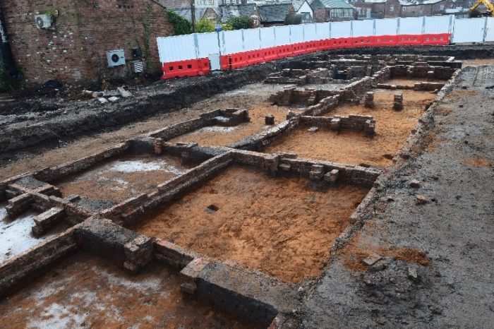
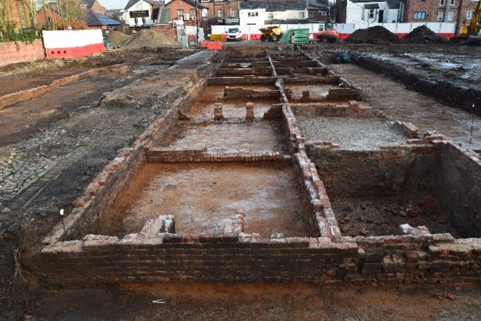
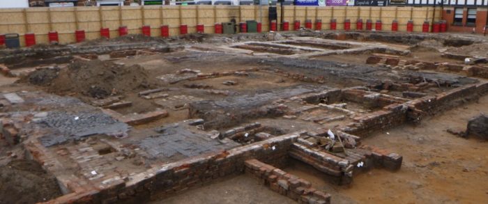
The excavation revealed several foundation structures belonging to Georgian terraces located on Albert Street, Chapel Street, Hope Square and Lloyd Square.
Contains public sector information licensed under the Open Government Licence v3.0
The Ordnance Survey has granted Archaeology Wales Ltd a Copyright Licence (No. 100055111) to reproduce map information; Copyright remains otherwise with the Ordnance Survey
The Ordnance Survey has granted Archaeology Wales Ltd a Copyright Licence (No. 100055111) to reproduce map information; Copyright remains otherwise with the Ordnance Survey
The foundations of terraced houses, a school, the former Wesleyan chapel, as well as cobbled streets were all uncovered. These structures were demolished between 1940 and 1960 and the subsequent car park was built over the top.
Our team of archaeologists uncovered the foundations during preliminary groundwork associated with the development of new residential apartments on the site.
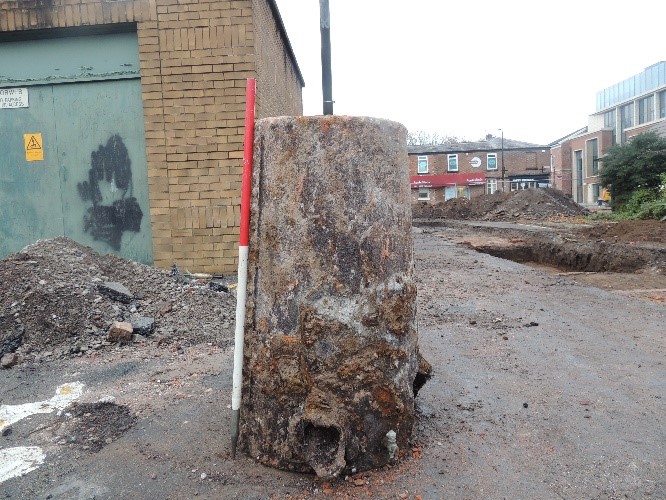
(Photo courtesy of Norman Redhead)
The information below will give an overview of the findings so far and how they relate to each specific historical street, providing a unique glimpse into the daily lives of the residents of this community. This is an ongoing investigation so not all questions have yet been answered, but we will update this page with new information as it comes in.
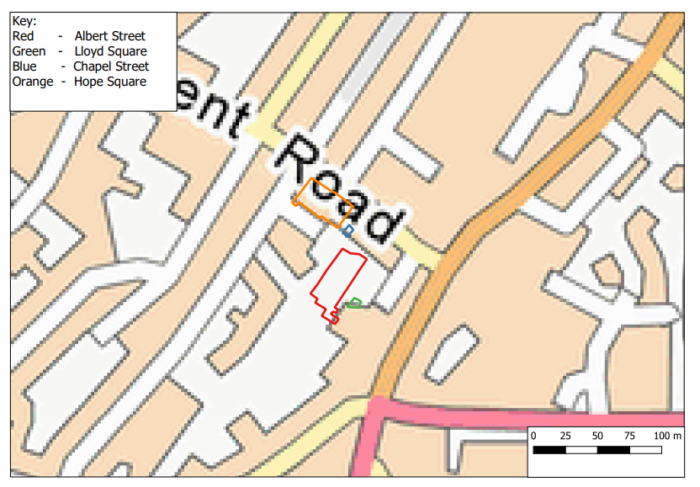
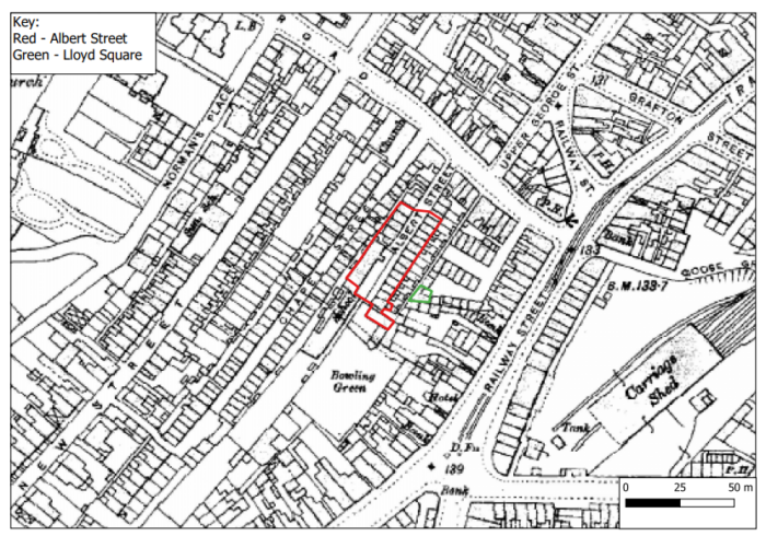
Albert Street
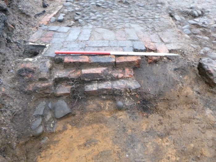
Albert Street was a late Georgian (early 19th century) street comprising the main extent of our excavation. The road consisted of grey cobbles approximately 3.5m wide, with stone-lined drains on either side. The buildings that lined Albert Street included terraced houses some with basements, a school and a chapel.
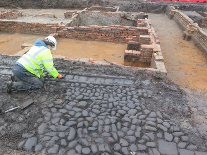
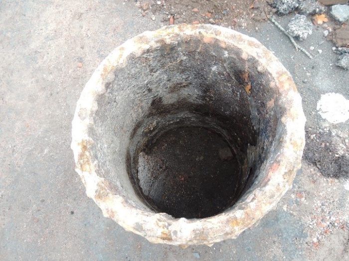
(Photo courtesy of Norman Redhead)
The street was home to a multi-cultural community of lodgers and their families. Initial census data research has revealed the professions of some of the residents included decorators, nurses, domestic servants and general labourers.
Our excavations revealed the remains of 14 houses located on Albert Street which were laid out as ‘two-up-two-down’ dwellings. Interestingly, some of the houses provided evidence of partition walls which separated one room into two separate dwellings, with a fireplace in each – an indication of the cramped living conditions in this densely populated area.
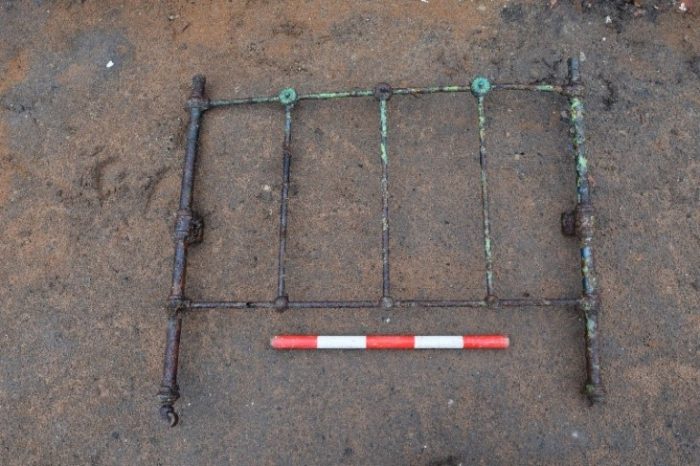
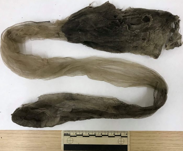
The last terraced house at the southern end of Albert street contained a cellar dwelling which yielded some amazing finds. These included a cast-iron Victorian bedframe with headboard, footboard and metal mesh canopy.
A singular silk stocking was also recovered from a hook on the wall of the cellar in this house. The stocking is of Cuban heel design, which was a style popular from the 1930s onward. The construction of the stocking, with a lack of keyhole in the welt indicates it probably dates to the mid-1930s.
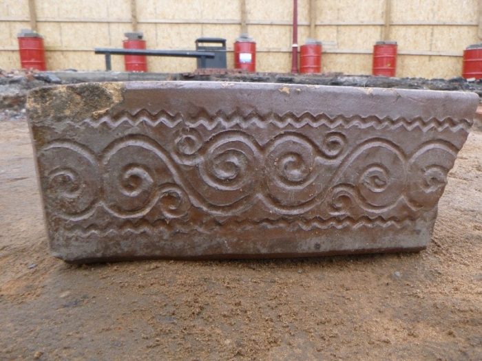
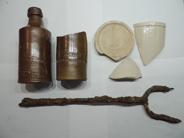
Other artefacts from Albert street included a chimney sweep brush, a Victorian coin dating to 1887 and a decorative red ceramic drain trough.
The southern limit of the excavation also revealed a number of larger buildings suggested to be the remains of a school labelled as St. Margaret’s School on the OS County Series map of Cheshire 1876. A larger rectangular structure to the left of Albert Street represented the main school building. A further large building with floor-supporting columns and a possible coal chute was also suggested to be part of the school, though this rectangular structure was not present on the 1876 map. However, it does appear on the OS County Series map of Cheshire from 1910, suggesting that it was a later addition to the school. Artefacts, such as an ink well and the metal sole of a child’s clog with some of the leather still attached were found in this area.
Adjacent to the school and bounding Albert Street was a large area, which has been interpreted as the school yard. Maps dating to 1876 show a Church named the ‘chapel of ease’ located next to St Margaret’s school. This structure is not denoted on later maps, suggesting that the building was utilised by the school as a part of its expansion.
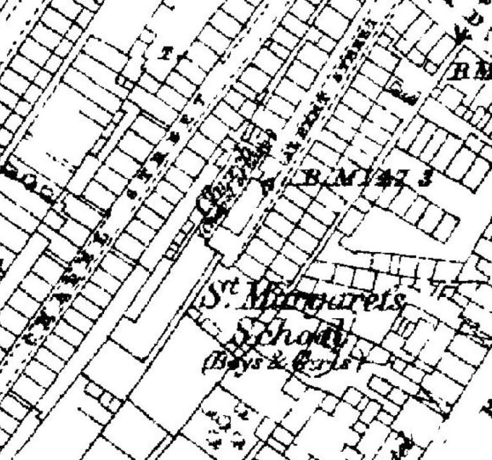
The Ordnance Survey has granted Archaeology Wales Ltd a Copyright Licence (No. 100055111) to reproduce map information; Copyright remains otherwise with the Ordnance Survey
The expansion of the school may be indicative of the increase in the population of the area during the mid-19th to early 20th centuries. This would be in-keeping with the industrial uptake experienced in this area during this time.
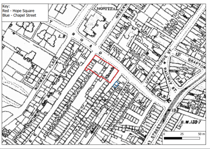
Chapel Street
Chapel Street was of very similar construction to Albert Street; again a red brick terrace built in the early 19th century street on a cobbled road edged with stone-lined drains.
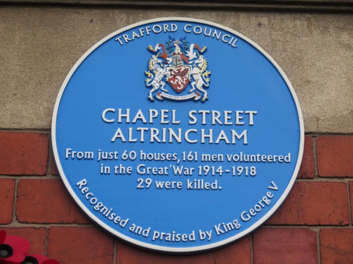
The street was home to a four hundred strong, again multi-cultural community of lodgers and their families and had a famous reputation due to the community’s commitment to the war effort during the First World War.
It is recorded that 161 men from just 60 houses on Chapel Street joined the war effort of which 29 were killed. A roll of honour was fundraised for by the inhabitants of the street and erected to be unveiled by the Earl of Stamford in 1919. At the unveiling a telegram from King George V was read out in recognition of their bravery. Newspapers at the time described it as ‘the bravest little street in England’.1 In 2009, a blue plaque was erected on the side of the The Grapes Pub (now Phanthong restaurant) in their memory.2
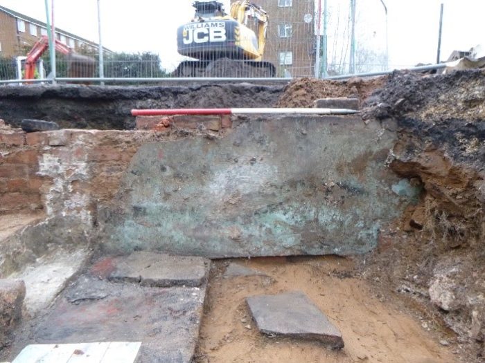
Our excavation of Chapel Street comprised of two trenches located to the rear of The Grapes Pub, revealing a portion of the street surviving under the Regent Road carpark. The first trench revealed the remains of a toilet block. It consisted of five layers of a brick surface truncated by a ceramic service drain.
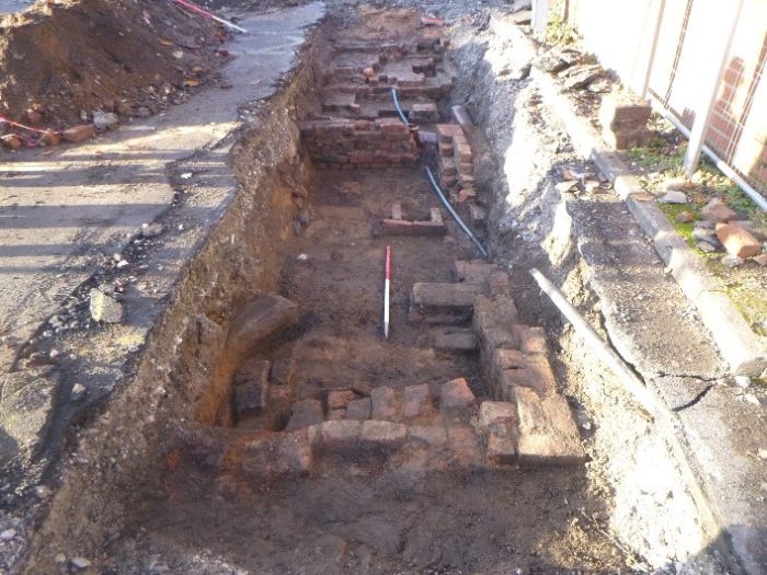
The second trench revealed the partial remains of a house. Although limited by the extent of the allotted trench, we were able to reveal two rooms and a basement in-section (visible within the trench wall).
Finds from this house included a stoneware bottle, a jam jar and a large metal toasting fork and across this area of the site further finds included a mixed array of pottery, glass bottles, animal bone and cockle shells. All are evidence of refuse from the inhabitants’ everyday lives at the time.
Hope Square & The Wesleyan Chapel
Hope Square was located in the northern area of the excavation. It comprised of a communal area sandwiched behind the houses on Chapel Road (Regent Road), New Street and the Wesleyan Church. The square consisted of grey cobbles, stone-lined drains, middens, privies and a water pump.
Our excavations revealed the remains of several square brick structures along-side a network of sewage pipes which were interpreted as the remains of privies. These facilities appear to be shown on the OS County Series Map of 1876, which displays several square structures. These facilities would have been shared between the houses, which back onto the square.
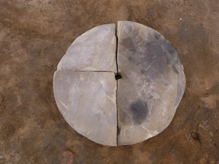
Finds from this part of site include many broken glass bottles, clay pipe stems and bowls and fragments of blue and white pottery, all of which are indicative of everyday refuse. What appears to be a knife sharpening stone was also recovered indicating the likely presence of cottage industries in the area.
The quality and size of the houses excavated indicate that the houses bordering Hope Square from Chapel Road were the smallest and had the poorest craftsmanship. This confirms what the documentary evidence tells us, that Hope Square comprised of the most poor and deprived housing in Altrincham.3 In 1851 a government inspector (Robert Rawlinson) commented on the state of Hope square, observing that the middens had not been emptied in over a year. 4
Surprisingly, in comparison to other structures on site, Hope Square and its surrounding houses appeared to be in a fair state of preservation. The cobbled square, brick surfaces and drains were surviving in large sections, and the foundation walls of the houses are relatively well-preserved with some degradation to the top courses of bricks.
The Wesleyan Chapel was located next to Hope Square. During our initial evaluation of the site, the basement to the chapel was revealed, which contained the remains of the chapel’s heating system. However, most of the remains of the chapel have been destroyed by the concrete foundations of the public toilets which were located on the site until recently. All that now remains of the chapel is the boundary wall close to Chapel Road.
Lloyd Square
Lloyd Square was a courtyard bounded by terraced houses situated off the eastern end of Chapel Road (Regent Road). It was located next to the south-eastern boundary of the site, near to Kings Court.
The excavations in this area revealed the remains of two ground floor rooms, a cellar and a courtyard. Due to issues of health and safety, the cellar could not be excavated fully, however the the rooms and courtyard were investigated.
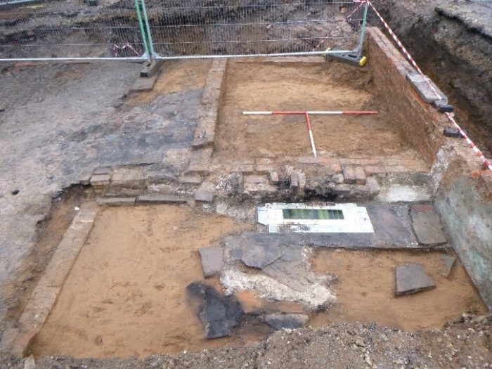
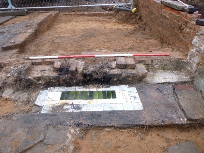
Within one of the rooms, the remains of a flagstone floor overlain with hessian-backed lino was present indicating renovations had taken place at some point in the house’s later existence. A fireplace with a bottle-green and white tile hearth surround was also uncovered. This was a unique feature, not found elsewhere on the site. Also still standing up to around 1m in height were the remains of one of the walls, with the remnants of the original plaster still present.
Abutting the two rooms were the remains of a cobbled and brick surface a comprising part of the courtyard. Observed within the brick surface were two post-holes and a square drain. One of the post-holes contained wooden remains and a stone-lining. The exact function of these features were not ascertained through excavation, however, it is suggested that it may be the remains of a gate or porch.
Finds from this area comprised of mixed array of post-medieval pottery, broken glass bottles, animal bones and clay pipe fragments, congruous with the typologies recovered across the site and representing the refuse from everyday life. More interestingly, a thin metal sign was recovered from a layer of mixed building rubble within Lloyd Square. The sign displayed partial writing referring to a pet shop. Perhaps an indication that a pet shop was located within the near vicinity of Lloyd Square at the time…
Post-excavation Research
By looking at census data we are beginning to build a picture of the inhabitants of these streets in the years leading up to their demolition. Census information is held for 100 years before it can be released and as such the latest census data that can be accessed currently is that from 1911. The 1921 census will be released at the beginning of 2022. There is unfortunately no census for 1931 due to being destroyed by a fire in 1942 and no census took place during 1941 due to the second world war6. However a register was taken in 1939 just after the outbreak of the Second World War in order to gather the information needed to produce identity cards, issue ration books, manage conscription and monitor population movement6. This provides us with some of the last available information about the inhabitants of these streets prior to their demolition.
Chapel Street
From the mapping evidence, we are confident that the house on Chapel Street revealed during excavation is No. 3. The data from the 1911 census reveals that the houses numbered 3, 5, 7, 9, 11 and 13 on Chapel Street were all referred to as a ‘Common Lodging House’. Lodging houses were popular accommodation for labourers during the 19th century as a cheaper alternative to renting. However, they presented a problem for social reformers such as Edwin Chadwick, who believed that the conflation of the working class in these environments exacerbated crime and disease8. The Public Health Act of 1848 sought to rectify and regulate the medical and social problems caused by common lodgings. It included passing by-laws which enforced a maximum number of lodgers per room and the segregation of the sexes. It also enforced regular inspections to ensure that these laws were upheld9.
According to the census, the common lodging house on Chapel street housed 56 residents across the 6 buildings in 1911. In No. 3 specifically, seven male boarders were listed. Their names and ages were Ernest Thomson (50), George Clarke (64), William Sharples (40), Albert Chaabane (19), Thomas Cadman (73), Peter Yesford (47) and Martin Griffin (51). Most were registered as general labourers, except for George Clarke who was listed as a tailor merchant servant and William Sharples as a stableman10.
It is clear from the census data that the inhabitants of this common lodging house were following the segregation laws enforced in 1848. Only 7 of the 56 individuals were women and all of them were registered at No. 7 Chapel Street10.
In terms of the famous First World War inhabitants of Chapel Street, three of the enlisted men are recorded as having lived at number 3 at some point within their lives (many of the soldiers resided in a number of addresses within the street throughout their lives). Their names were Robert Burns, James Hulmes, and William Ratchford1. All appear on the roll of honour that was placed in the street after the war.
The latest information available detailing the inhabitants of No. 3 Chapel Street can be found within the 1939 Register. Chapel street was issues with a clearance order from the council in 1936, but the area wasn’t fully cleared until 1958. No. 3, 5, 7, 9 and 11 were all bought by the council in 1943 for a sum of £325 and demolished soon after1.
The register suggests that No.3 and 5 were regarded as the same residence and may indicate a similar set up to the lodging house that had existed in the previous decades. Within No. 3-5 Chapel Street, 19 men resided during 1939: John Hudson (63), Patrick Hunt (53), Arthur Kennedy (45), William Lamb (60), Martin Mulligon (28), Michael Mary (71), Patrick Smith (67), Daniel Sulleran (60), Joseph Smallwood (62), James Lunney (63), John J Webb (62) John Clinton (53), John Allen (51), Thomas Barlow (72), Michael Cunningham (64), Herbert Chorlton (51), Arthur Foxley (63), Peter Gaynor (53) and Joseph Griffiths (28).
John Hudson and Peter Gaynor were listed as nurserymen’s labourers, Patrick Hunt, Martin Mulligon and Herbert Chorlton were farm labourers, Patrick Smith was a market gardeners labourer, and Arthur Foxley was a council labourer. The rest of the residents were listed as general labourers11 .
So far we have found no further information about the final years of No.3 Chapel street, but it is unlikely that the use of the building changed substantial in the final 4 years, particularly as the clearance order had already been set in motion.
Next Stages
While site work has now finished, the investigation into our findings from beneath Regent Street carpark continue. Our post-excavation research hopes to uncover more information about each of the streets uncovered in this investigation by looking through census records to ascertain information on individual households and residents. This process is ongoing, and we aim to provide updates here and on our social media accounts on Facebook and Twitter as further information comes to light.
If you have any questions about site, please contact our team through the Contact Us button at the top of the page.
References
1 Cliff, K. and Trafford Local Studies. 2018. The Bravest Little Street in England. Stroud: Amberley Publishing Limited
2 https://www.trafford.gov.uk/residents/leisure-and-lifestyle/libraries/blue-plaques-in-altrincham.aspx
3 Bayliss, D. 2006. A Town in Crisis: Altrincham in the mid-19th Century. Hale: Don Bayliss, pg.30
4 Appendix 2: The Report for the Government by Robert Rawlinson, 1851 in D. Bayliss (Ed). 2006. A Town in Crisis: Altrincham in the mid-19th Century. Hale: Don Bayliss. pp.66-69
5 Southern, P. 2008. The Story of Altrincham. Stroud: Amberley Publishing Limited.
6 https://www.nationalarchives.gov.uk/help-with-your-research/research-guides/census-records/
7 https://www.nationalarchives.gov.uk/help-with-your-research/research-guides/1939-register/
8 Hamlin, C., 1998. Public Health And Social Justice In The Age Of Chadwick. Cambridge: Cambridge University Press, p.166.
9 https://www.parliament.uk/about/living-heritage/transformingsociety/towncountry/towns/tyne-and-wear-case-study/about-the-group/housing/lodging-houses/
10 1911 England Census, Class: RG14; Piece: 21533, Accessed via www.Ancestry.com
11 1939 England and Wales Register, RG 101/3980G, Accessed via www.Ancestry.com