
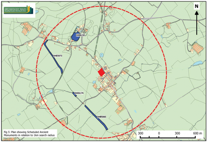
Geophysical surveys were carried out at Lyonshall, Kington, Herefordshire, prior to the submission of a planning application for the construction of housing. The work was informed by previous archaeological investigations undertaken in relation to the same development proposal, which included a Desk-based Assessment and Evaluation Trenching.
The Desk-based Assessment highlighted a potential for the survival of medieval burgage plots and structural remains within the development site. This was confirmed by the Evaluation Trenching, which identified the remains of approximately four stone-built medieval road-frontage structures and associated domestic features. Analysis of the large ceramic assemblage recovered suggested occupation during the 13th and 14th centuries, with later small-scale activity during the 17th century.
The geophysical survey was undertaken with the aim of determining the likely spatial extent of the building remains at the site. This followed advice from the Herefordshire County Archaeologist, that any such remains should be protected and preserved in situ. The work was undertaken with two machines to ensure the best quality results: a Bartington Grad601 gradiometer and a Geoscan RM85 resistivity meter with PA20 multi probe array.
The results of the survey were generally consistent with those of the Evaluation Trenching, particularly in the northeast and the centre-east, where the remains of the four road-frontage buildings were identified. However, the results allowed a more detailed and nuanced interpretation of the medieval development pattern to be formed. The principle conclusions were that buildings with masonry foundations did not occupy the entire street frontage, and that the more intense structural activity associated with a house platform identified in the northeast was probably an isolated occurrence. New evidence was also represented by a linear feature, apparently a bank and ditch with an associated entranceway, which cut diagonally across the road frontage area in the east.
The improved understanding of the medieval layout of the site resulting from the survey allowed the developer to prepare a revised proposal that avoided construction within areas containing extant medieval building remains, the threat to which was the main concern of the Herefordshire County Archaeologist. In addition, the revised development proposal incorporated measures designed to facilitate the long-term preservation of the medieval remains by raising the levels of roadways, driveways and garden soils.